


Trainsity Kuala Lumpur LRT KTM
Beschreibung von Trainsity Kuala Lumpur LRT KTM
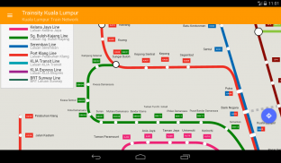
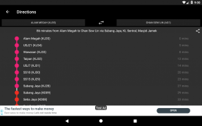
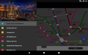
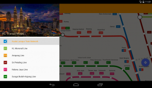
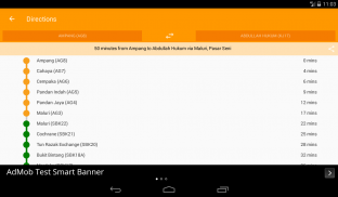
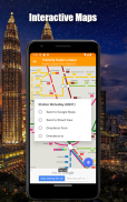
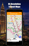
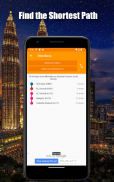
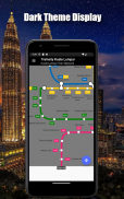
Verwenden Sie die hochauflösenden Vektorkarten der Linien KTM Komuter, RapidKL und KLIA Express Rail Link, einschließlich der BRT Sunway-Linie, um sich in der Stadt Kuala Lumpur zurechtzufinden. Die Karten haben eine geringe Dateigröße, aber viele Zoomstufen und können offline ohne Verbindung zum Internet verwendet werden. Benutzer können auf die Bahnhofsbezeichnungen klicken, um Google Maps oder Street View zu öffnen. Dort können sie alle Funktionen der Google Apps nutzen, um die Umgebung zu visualisieren und / oder Routenberechnungen durchzuführen. Es gibt auch eine Offline-Funktion, um die beste Art der Fahrt von einem Bahnhof zu einem anderen Bahnhof mit Richtungsangabe und Zeitangaben (die von der tatsächlichen Fahrzeit abweichen können) zu berechnen.
* Jetzt mit dunklem Modus
Trainsity Kuala Lumpur LRT KTM – Version 2.10.0
(15-01-2025)Trainsity Kuala Lumpur LRT KTM – APK Informationen
APK Version: 2.10.0Paket: com.dom925.trainsity.kualalumpurNeueste Version von Trainsity Kuala Lumpur LRT KTM
Weitere Versionen


 4.1
4.1


Apps in derselben Kategorie

Das könnte dir auch gefallen...


